
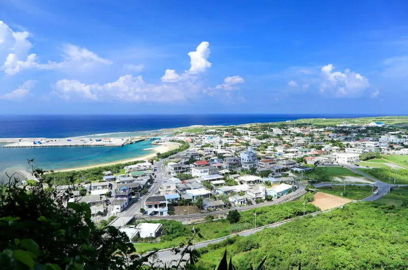
Yonaguni Island is the westernmost island of the Yaeyama Islands in the Ryukyu Islands, and the westernmost island of Japan. It is located off the northeast coast of Taiwan, approximately 111 kilometers from Taiwan. On a clear day, the mountains of Taiwan can be seen in the distance. The entire island belongs to Yonaguni Town, Yaeyama District, Okinawa Prefecture, Japan. In 1985, Yonaguni Island The island became famous after large, cut stone building remains were discovered on the surrounding seabed.
Island Overview
The island stretches approximately 12 kilometers from east to west and 4 kilometers from north to south, with a coastline of 27.49 kilometers and an area of 28.88 square kilometers. Forests and wastelands cover 16.74 square kilometers. The island's terrain is mostly mountainous and valley-based, with some plateaus and wetlands. Mount Urabu, at 231.3 meters above sea level, is the highest point on the island, located in the central-eastern part of the island.
The island has abundant freshwater resources, with ponds and wetlands in the western part of Kuburi. In addition, the island is home to a large, non-venomous snake, reaching up to 2 meters in length, commonly found in plains, wetlands, and hilly areas.
Geology and Climate
The island's geology is primarily sandstone and shale, with limestone distributed in the northern and central regions. The coastline consists mainly of cliffs and rocky shores, with beaches concentrated in the northeastern part of the island, near Zuna Village, and near the mouth of the Bichuan River. The surrounding sea areas have relatively high water temperatures, with seasonal averages of 24°C in winter, 26°C in spring, 29°C in summer, and 26°C in autumn.
Tourism features
Although it requires two transfers to get to this small island from Taiwan, its remoteness and inconvenient transportation have allowed Yonaguni Island to retain its pristine natural scenery. Whether cycling around the island or snorkeling in Zuna Harbor, the experiences are breathtaking.
The area around Nishizaki Lighthouse and Kubura Port is the closest point to Taiwan. A monument marking Japan's westernmost point is located next to Nishizaki Lighthouse, indicating a distance of 111 kilometers from Taiwan and 1990 kilometers from Tokyo. It is said that the best time to view Taiwan's Central Mountain Range is before a typhoon arrives.

Underwater ruins
The underwater ruins on Yonaguni Island include remnants of the last Ice Age, remains of terrestrial flora and fauna, and stalactite formations. This evidence suggests that the underwater structures may be between 3,000 and 10,000 years old, making them potentially one of the oldest known underwater sites in the world.
However, it should be noted that the southwest monsoon (during spring and summer) brings larger waves, which may affect plans to visit underwater ruins by boat or diving.
Island life and industry
Yonaguni Island has an area of approximately 28.88 square kilometers and a population of about 1,745. The island's industries include fishing, sugarcane farming, dairy farming, and tourism. Cattle and horse pastures are located on the southern side, while shrimp farms are situated along the coast.
There are three main villages: Sonai in the north, Kubura in the west, and Higawa in the south. The town hall is located in Sonai.
Yonaguni Island attracts tourists from all over the world with its unspoiled natural scenery, historically valuable underwater ruins, and unique geographical location.
--------------------
Japan Tour
▶️Plan your trip now